By Jeremy Menzies
Earlier this month, we launched free weekend shuttle service in the Central Subway. And come January 7th, our 4 new stations will connect directly to the rest of the T line from Sunnydale to Chinatown. Through this two-part blog series, we will look back at some of the history of the T from the 1860s to today!
In Part One, we’ll look over the first 150 years from the 1860s to the 2000s. Next month in Part Two, we will take a closer look at the history of the T and Central Subway projects leading up to today’s service.
The Horsecar Era: 1860s-1890s
Starting in the 1860s, transit service along today’s T Line was provided by horsecars. These were small rail cars (that looked much like a cable car) that were pulled along tracks by horses. Two companies, the Omnibus Railroad and the North Beach & Mission Railway, operated horsecar lines on parts of the path of today’s T. These lines were mainly meant to connect North Beach with the 3rd and 4th street corridors as far south as about Townsend Street.
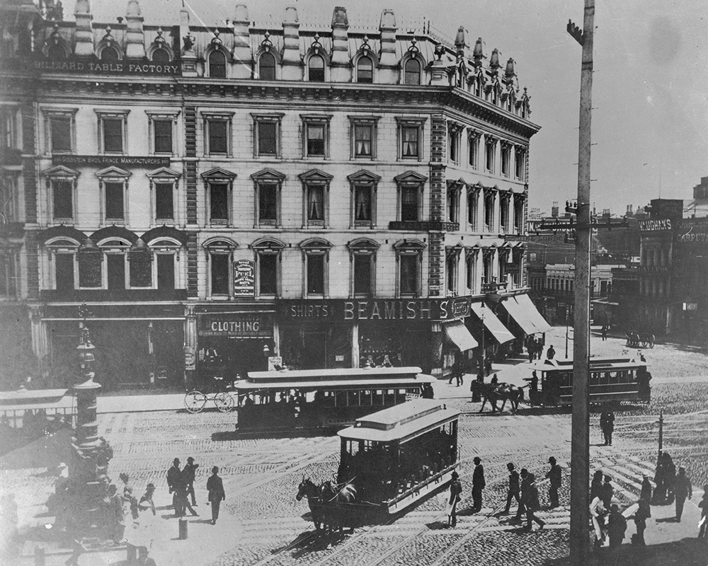
This photo circa the 1880s shows the busy intersection of Kearny, Geary, 3rd and Market streets, looking south to 3rd. In the foreground is a horsecar running up Kearny from 3rd.
Further south on 3rd (then called Kentucky Street), horsecars were operated by the Potrero & Bay View Railroad. Here the route ran over two bridges across Mission Bay and Islais Creek (known as “Longbridge”), ending near today’s 3rd & Gilman. This route served the industrial heart of San Francisco and opened up development in the Bayview but was not very profitable because of its length.
The Electric Streetcar Era: 1890s-1940s
The 1890s marked the dawn of the electric streetcar era in San Francisco. A new technology, electric-powered cars could carry more people over longer distances faster than both horse and cable cars. On top of that, they were cheaper to operate and increased profit potential for transit companies.
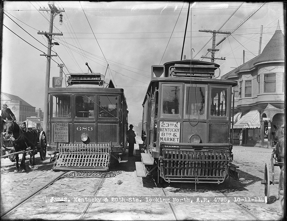
This 1911 photo shows two cars passing at 3rd (Kentucky) and 20th streets. On the left is a 16 Line car running to its terminal in the Bayview. At right is a 30 Line car heading north to 8th and Market.
In 1894, the first electric streetcar line began operating along parts of today’s T Line. Known as the 3rd & Kearny Line, it followed much the same route as the early horsecars from North Beach to the Southern Pacific Railroad Depot on Townsend Street. It was extended into the Bayview to 3rd and Palou and eventually was reformed into the 15, 16, and 29 Lines. Each of these served a different portion of the corridor covering differing needs of riders travelling through downtown or all the way out to the Bayview.
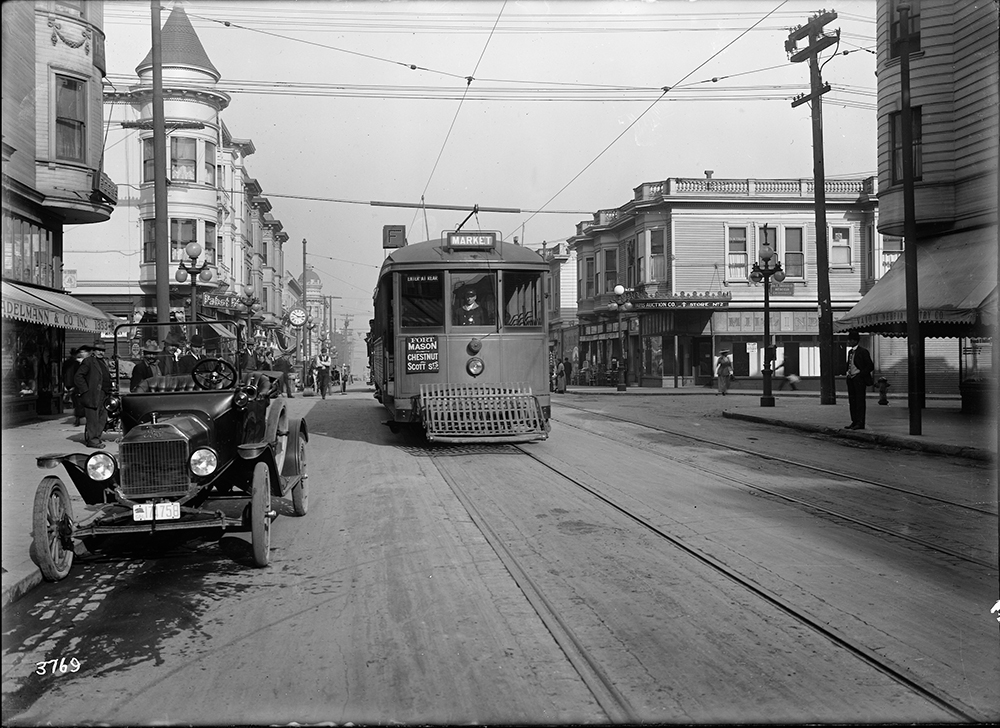
A Muni F Stockton streetcar passes Vallejo Street in this photo from 1916.
Muni’s first streetcar line to serve a similar route to the Central Subway portion of the T was the F Stockton, which opened for the 1915 Panama Pacific Exposition. The F Line ran along 4th and Stockton streets to serve South of Market, Union Square, Chinatown and North Beach before heading out to end at Chestnut and Scott streets.
Buses along the Bay: 1950s-2000s
Following World War II, the 3rd Street corridor was among the many that saw transit service shift from streetcars to buses. By 1951, the 15 Kearny route served much of the area once covered by the 15, 16, and 29 streetcar lines.
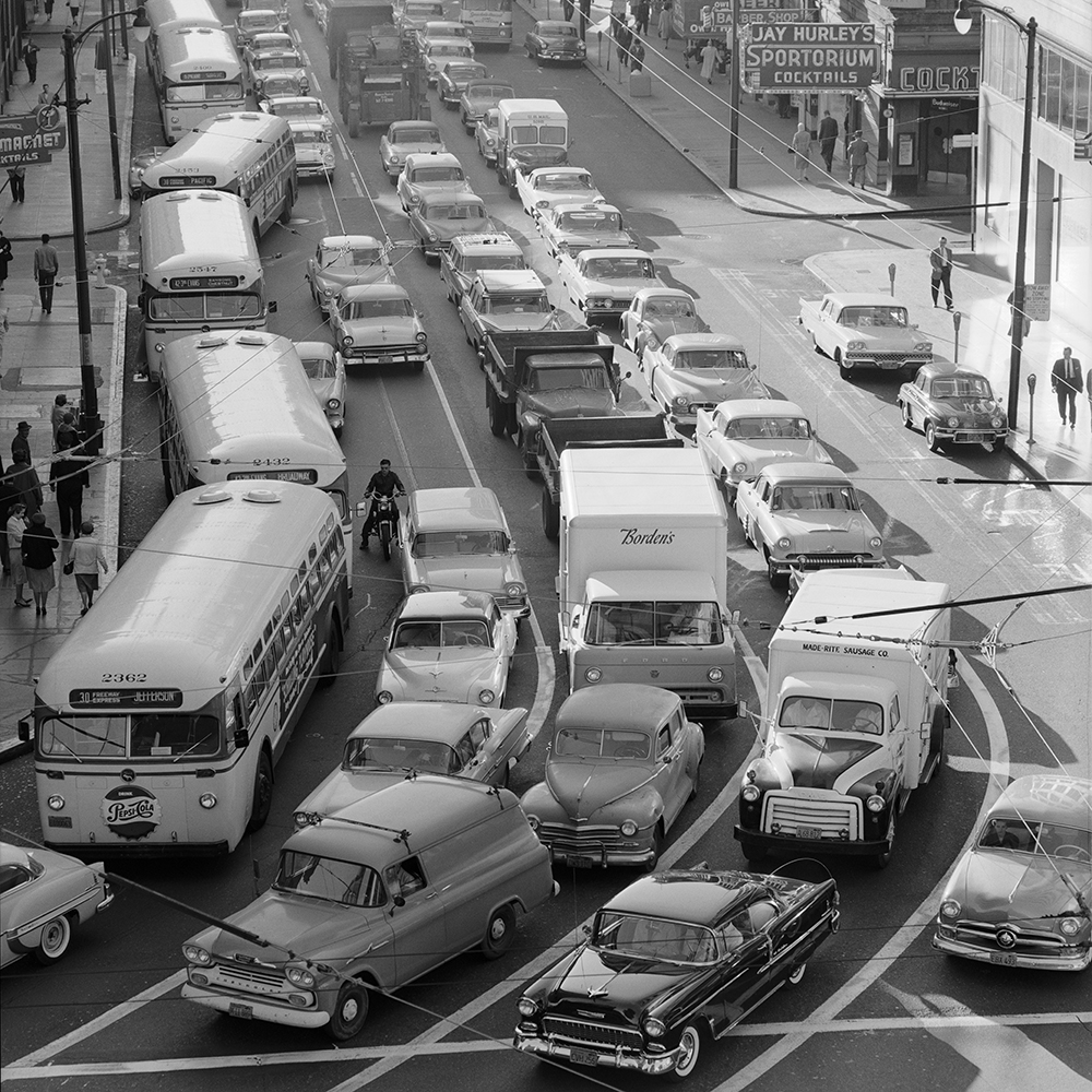
Buses on the 30, 15 and 42 fight the morning rush northbound on 3rd Street in this 1959 photo.
Traveling along portions of today’s 8 Bayshore and T Third, the 15 route went from Powell and Jefferson streets all the way to Geneva and Mission. Eventually, it was extended to City College on Ocean Avenue. While not the only route to serve the area, the 15 carried the bulk of the load for people wishing to travel along this corridor.
On Stockton Street, the 30 Stockton bus took over for the F, following the same route through Chinatown, Union Square, and South of Market to 4th and Townsend streets.
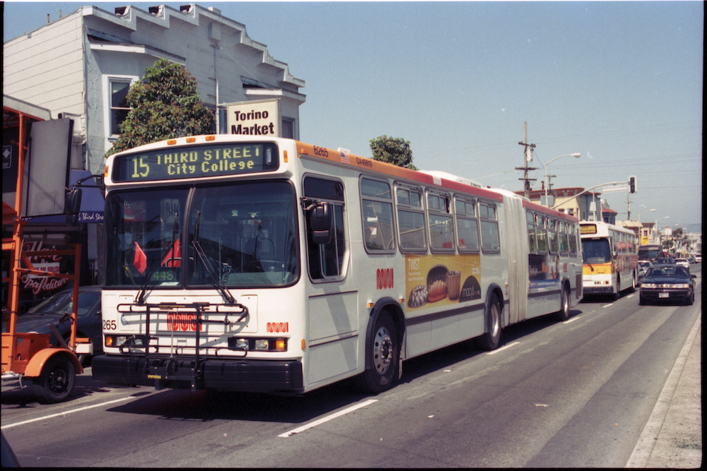
Many long-time riders will recognize this view of a 15 bus on 3rd & Palou. Discontinued with the opening of the T Line in 2007, the 15 was revived as the 15 Bayview-Hunter’s Point Express in 2021.
Tune in next month for a closer look at the history of the T Third and Central Subway Projects.
Published December 01, 2022 at 06:08AM
https://ift.tt/nlmXox0
Comments