By Eillie Anzilotti
After over a year of Slow Streets providing safe, low-volume corridors for people to walk, bike, play and travel during the pandemic, we’re excited to share our first comprehensive evaluation of the program. The key takeaway? San Franciscans are overwhelmingly in support of Slow Streets.
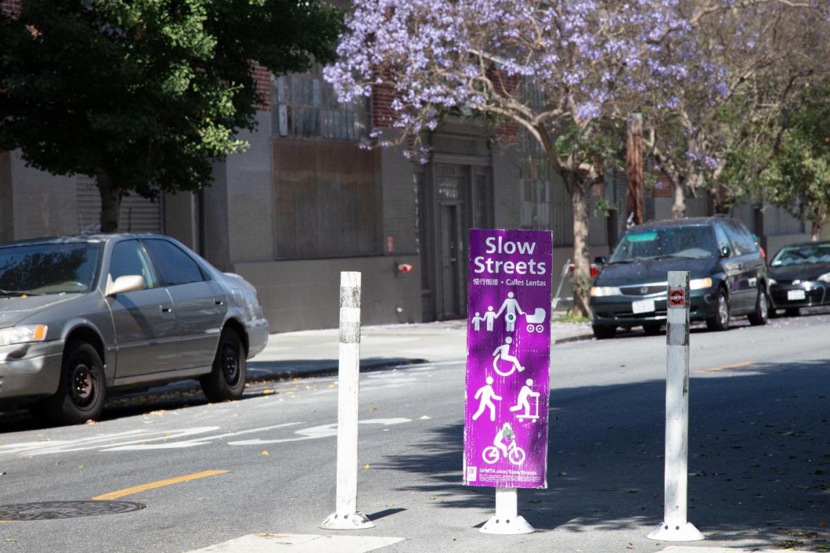
Slow Streets are designed to limit through traffic on certain residential streets and allow them to be used as a shared roadway for people traveling by foot and by bicycle. Since introducing Slow Streets in April 2020 in response to the Mayor’s Emergency Health Order, SFMTA has designated around 30 corridors covering 47 miles of roadway as Slow Streets. The program has evolved from a critical component of San Francisco’s pandemic response and recovery to a potential new avenue to further the city and SFMTA’s goals around climate action and sustainable transportation.
As the Slow Streets program has grown, we wanted to make sure we were understanding its impact on residents and city streets. Over the course of the program, we sent out a mail survey to anyone living within 0.25 mile of a Slow Street. We received over 15,000 responses on overall opinions of the program, how frequently residents use the streets, their experience when doing so and if they’d like to see the program continue. In tandem, we analyzed data on traffic volumes, vehicle speeds, collisions, bicycling and pedestrian volumes and spillover traffic impacts on adjacent streets to understand how the Slow Streets designation is changing conditions along the corridors.Through this initial evaluation, we were able to answer some of the main questions about Slow Streets that have come up over the past year and a half:
How do people feel about Slow Streets?
Residents who responded to the survey overwhelmingly supported the program. And, they noticed improvements in safety across the board: 71% agree that a street designated as a Slow Street became safer after the change.
Do Slow Streets impact traffic conditions on surrounding streets?
Our analysis of traffic data on adjacent streets shows that overall, Slow Streets do not cause an increase in traffic. We recognize, though, that COVID impacted traffic volumes throughout the city and we will continue to monitor for impacts as traffic conditions evolve.
Does a Slow Street designation make the road safer?
Of the Slow Streets in the network, 100% met the baseline conditions for a low-stress facility—fewer than 3,000 average daily vehicles and typical vehicle speeds of less than 25 mph. After a street is designated as a Slow Street, it sees, on average, a 35% decrease in daily traffic and a 14% decrease in vehicle speeds—along with a 36% decrease, on average, in collisions across the network.
Do Slow Streets encourage more people to walk or bike? In evaluating the Slow Streets program, we saw a virtuous cycle unfold: The less traffic on the street, the more likely people are to use it for biking and walking—and the more people use the street for safe and sustainable transport and play, the more likely others are to join in. Seeing young people learning to ride bikes on a number of Slow Streets was a sign that the roads were safe enough for all users.
This Evaluation Summary shows data spanning from June 2020 through July 2021 for each of the corridors in the program, with a handful of exceptions that are outlined in the report.
Next Steps
As San Francisco continues to move through the COVID-19 crisis, we are beginning the process of transitioning Slow Streets to from an emergency response measure to an ongoing program. We were able to use the data shown in this report to determine the first four corridors to remain in place after the pandemic: Sanchez Street, Shotwell Street, Golden Gate Avenue, and Lake Street. More information about the plans for these streets is available at Post-Pandemic Slow Streets.
We will continue to evaluate all existing Slow Streets to determine their post-pandemic future. To learn more about the overall program, visit Slow Streets.
Published September 25, 2021 at 03:44AM
https://ift.tt/3CHm8Gc
Comments