By Amy Fowler
A new traffic signal, crosswalk striping, pedestrian bulbs and streetlights help improve safety for people walking at Geary and Cook
The Geary Rapid Project may be best known for helping to make 38 Geary trips—well, more rapid. But, along with improving transit performance and reliability along a three-mile stretch of Geary, an equally important feature of the project is to make the streets safer.
Geary is part of the high-injury network, and people walking there are eight times more likely to be involved in a serious or deadly collision than the average San Francisco street. Highway-like conditions on Geary Boulevard in the Western Addition make for challenging crossings. And the Tenderloin to the east, with its high concentration of children, seniors and people with disabilities, is uniquely vulnerable to traffic violence.
Fortunately, many of the safety improvements included in the Geary Rapid Project have already been completed, with more underway. Here are a few highlights:
- New crosswalks. Steiner Street has a new look since the non-ADA compliant and seldom-used pedestrian bridge was removed last May. The surface-level crosswalk on the west side of the intersection, where the bridge had been, has been improved with new median refuges, while the east side is sporting a newly activated crosswalk. At Webster, two new crosswalks were built across Geary to supplement the Japantown pedestrian bridge. When the final striping and decorative pavers are completed, the new crosswalks will be not only be safer, but easier on the eyes.
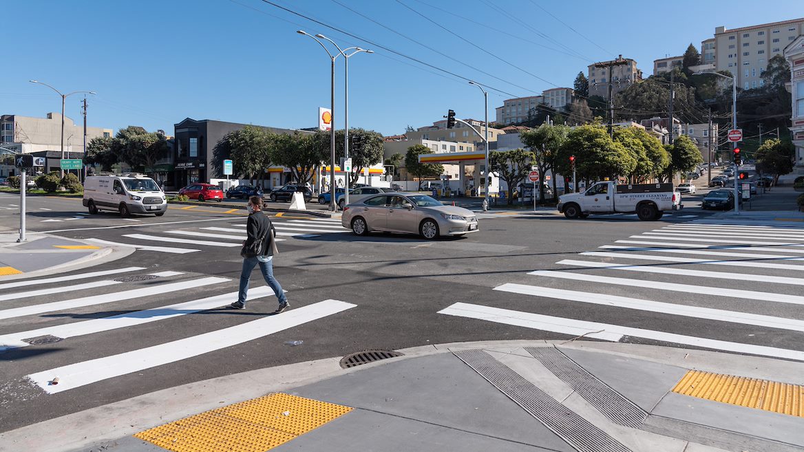
- New traffic signals. A new traffic signal at Cook Street was just turned on in January and another signal at the intersection of Commonwealth/Beaumont will be activated this spring, which means every crosswalk on Geary Boulevard as far west as 31st Avenue will benefit from signals.
- New pedestrian countdown signals. The Fillmore intersection, which had no pedestrian countdown signals crossing Geary, now has them at all four crosswalks. And Divisadero, Scott and Laguna streets also gained countdowns for people crossing along Geary, so now every signalized intersection on the Geary corridor—over five miles—has countdowns.
- Signal rephasing and “leading pedestrian intervals.” Re-timed traffic signals at the Masonic intersection added more time to cross the street and protection for westbound bicycles turning left. Other intersections, such as Scott Street, received upgrades to give people walking a head start before vehicles.
- New "pedestrian bulb-outs” between Stanyan and Market streets. These curb extensions shorten crossing distances for people walking and encourage vehicles making turns to slow down.
- Left turn safety. Left turns are one of the leading causes of traffic collisions. At Geary and Leavenworth, a protected left turn arrow was added for northbound traffic to separate people walking from turning vehicles.
Based on advocacy from local communities, we also added safety improvements that weren't envisioned in the initial Geary Rapid Project design. For example, a new traffic signal will be installed at Commonwealth Avenue. "The crosswalk on Geary at Beaumont and Commonwealth has been a dangerous intersection for many years," noted Tom Barton, a long-time Richmond resident who campaigned for the signal. "Having a crossing signal there will provide a safe way to cross, especially with heavy traffic, for myself and families, and other people crossing there."
Last summer, following a tragic fatality at Geary and Gough, the SFMTA met with District Supervisors Preston and Stefani as well as local residents, who expressed a desire for additional safety measures such as reducing the speed limit near senior facilities. While existing state law makes it difficult to lower speed limits, the SFMTA was able to make use of a seldom-used exemption to reduce the speed limit on Geary from 35 to 25 mph on blocks near senior centers: between Gough and Laguna, Steiner and Scott, and Baker and Lyon streets.
Final safety improvements planned as part of the Geary Rapid Project include building a new signalized crosswalk at Buchanan Street, completing the remaining traffic signal upgrades and pedestrian bulb-outs and roadway restriping to “calm the Expressway.” Those are expected to be completed this summer.
For more information visit the Geary Rapid Project website.
Published February 12, 2021 at 04:17AM
https://ift.tt/3qdGX6k
Comments